[Fall 2007]
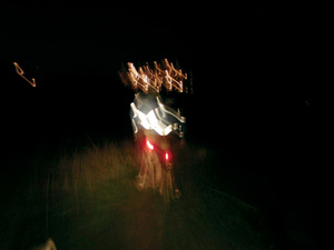
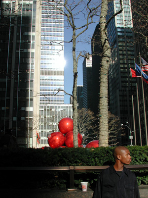
Don Sinclair, Variations / Variantes, 2003, projet Web/Web project. © Don Sinclair
Don Sinclair, Variations / Variantes, 2003, projet Web/Web project. © Don Sinclair
Don Sinclair, Variations / Variantes, 2003, projet Web/Web project. © Don Sinclair
Don Sinclair, Variations / Variantes, 2003, projet Web/Web project. © Don Sinclair
Don Sinclair, Variations / Variantes, 2003, projet Web/Web project. © Don Sinclair
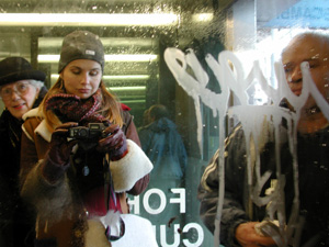
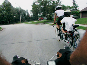
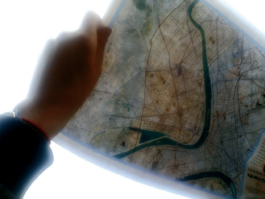
Marketa Bankova, New York City Map, 1999-2003, Web project/projet Web. © Marketa Bankova
Marketa Bankova, New York City Map, 1999-2003, Web project/projet Web. © Marketa Bankova
Marketa Bankova, New York City Map, 1999-2003, Web project/projet Web. © Marketa Bankova
Marketa Bankova, New York City Map, 1999-2003, Web project/projet Web. © Marketa Bankova
Marketa Bankova, New York City Map, 1999-2003, Web project/projet Web. © Marketa Bankova
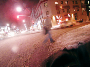
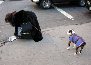
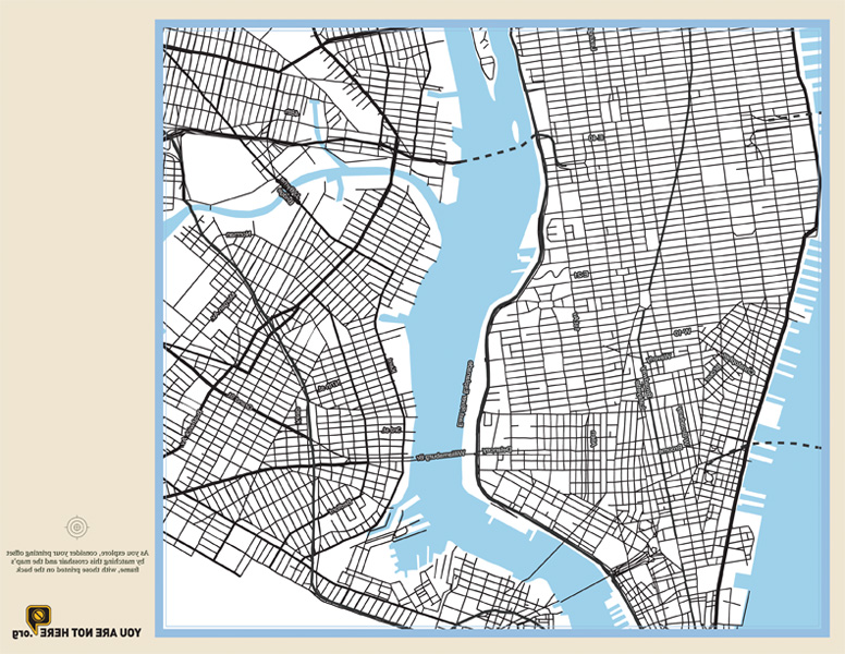
Mushon Zer-Aviv, Kati London, Dan Phiffer, Thomas Duc, Charles Pratt, Ran Tao, You Are Not Here: A Walking Tour of Baghdad through the Streets of New York City, 2006. Web project and city-wide site specific installation. Projet web et installation.

Mushon Zer-Aviv, Kati London, Dan Phiffer, Thomas Duc, Charles Pratt, Ran Tao, You Are Not Here: A Walking Tour of Baghdad through the Streets of New York City, 2006. Web project and city-wide site specific installation. Projet web et installation.
Mushon Zer-Aviv, Kati London, Dan Phiffer, Thomas Duc, Charles Pratt, Ran Tao, You Are Not Here: A Walking Tour of Baghdad through the Streets of New York City, 2006. Web project and city-wide site specific installation. Projet web et installation.
by Sylvie Parent
An awareness of geography has never been totally absent from the Web. At first, however, it tended to be obscured behind utopian discourses on planetary connectivity. As the early enthusiasm about the Internet developed, regional places and specificities tended to become blurred.
In recent years, though, free, user-friendly cartography tools and satellite imagery, such as Google Earth, Google Maps, and Virtual Earth, have invaded the Web and become popular among Web navigators. In addition, GPS geolocation systems, integrated with wireless devices, are gradually seeping into the digital universe and communications networks. Use of these tools is now so widespread that there is a name for the ever-growing part of the network that contains geographic data: the “Geographic Web,” or “Geoweb.”1
Unfailingly, photography has found its rightful place in practices focusing on localization. The Flickr site, paired with Yahoo! Maps, displays collections of images, indexed according to geographic site – “geotagged” photographs. In Google Earth, satellite photographs of Earth are accompanied by photographed views supplied by users. And these are just a couple of examples in a sector that is constantly expanding and diversifying.2
In the domain of creativity on the Web, geographic awareness has taken varied forms since well before the Geoweb was created. Travel accounts, within autobiographical practices, quickly appeared on the Web. Philip Pocock and Felix S. Huber’s projects, such as Arctic Circle (www.dom.de/acircle), are reminiscent of early photographic expeditions in the second half of the nineteenth century. These artists travelled around the Arctic Circle in 1995, under conditions that were sometimes extreme, and they made the voyage into a performance during which the publication on the Internet of their multimedia account proved to be a true human and technical challenge for the time.3
Just like Arctic Circle, Equator and Tropic of Cancer refer to encompassing geographic situations, to imaginary lines that circle the planet. These projects established links between territories otherwise separated by natural and geopolitical boundaries, and in doing so created an analogy with the transnational span of the Web. To virtual travels taken on the Internet, they responded with physical travels in order to bring multiple sites to light and extend the horizon of cyberspace at a time when the technology was still nascent.
Of course, artists have also used photography to make records of nearby sites and thus introduce physical places, known and experienced, to cyberspace. In these photographic practices, the view of the familiar environment is often imbued with the connection between place and artist. The artist asserts a situated identity in such sites. In the dynamic context of the Web, this localization, with its emotional and social dimensions, is not fixed but moves with its maker, as in Annette Weintraub’s Sampling Broadway and Pedestrian (http://annetteweintraub.com), and Marketa Bankova’s New York City Map (www.nycmap.com/index.html). The personal itineraries in sunset on st-viateur (www.nette.ca/art/sunset) by Jeannette Lambert or les huit quartiers du sommeil (http://luckysoap.com/huitquartiers) and in Jessica R. Carpenter – using maps created through Google Maps – form accounts that are based on the capacity of a site to solicit individual references.
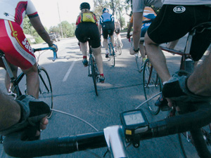
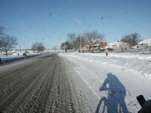
In fact, a number of these projects testify to the urban experience in large cities where digital technologies and telecommunications are omnipresent. Locative media – media that include a geolocation system – have already given rise to a number of art initiatives and to many other social interactions.4 These productions usually have two phases: performance and data collection, then publication on the Web. For example, Don Sinclair’s bike rides in Variantes (http://dataspace.finearts.yorku.ca:16080/variations) bring together diverse data that help to convey this multidimensional experience.5
A number of group projects set up in recent years are based on a multiciplicity of points of view in an approach to territory that counts on contributions by a number of individuals. Here, the Web is not simply a space for publication and presentation, but also a place for meeting, reflection, and participation. This is the case, for example, for Cartografia Resistente (www.mappeaperte.net/cartografiaresistente), created by a collective in Florence in 2004, that is defined as a laboratory for urban experiments. This project is based on the notion of the artist as stroller, and on the concept of a stroll as an art experience.
Other comparable productions associated with psychogeography6 have given rise to a wide variety of results. The Glowlab group (www.glowlab.com), responsible for the annual Conflux festival (www.confluxfestival.org), has instigated a number of initiatives, including Garbagescout (http://garbagescout.com), the objective of which was to recycle abandoned objects. Contributors to this site could post a photograph of an object destined for the trash along with a map locating it in a city (New York, Philadelphia, or San Francisco) in the hope of finding it a new home. Meanwhile, the artist Antoni Abad (www.zexe.net/barcelona), with the contribution of forty handicapped people armed with camera phones, created a map of Barcelona that shows the places inaccessible to wheelchairs, with photographs and messages as evidence. Such community-participation initiatives are building an unprecedented and critical picture of urban tourist centres.
…the lack of differentiation leads participants to examine the feeling of ubiquity that they experience on the Web.
The notion of a game also serves as a foundation for the creation of group works that take the form of performances and virtual interactive spaces. Snap-Shot-City (http://snap-shot-city.com) a photographic treasure hunt organized by theme, took place in a dozen cities and involved some fifty competing teams. Meanwhile, Olivier Vanderaa, avec Citysnapper Game (www.o-vanderaa.com/citysnappermain/index.htm), produces photographs of urban sites, responding to requests made by telephone, and publishes them on the Web in an interactive environment the interface of which changes with each city (Brussels, Rotterdam, Montreal, Barcelona, Kortrijk).
Still in a playful mode, Olga Kisseleva asks “Where are you?” (www.chambreblanche.qc.ca/labweb/way/intro.html) in a work that presents photographs taken in a number of cities and asks visitors to the site to guess where the images come from. Most people don’t win the game, and this points up the phenomenon of homogenization of urban centres. Moreover, the lack of differentiation leads participants to examine the feeling of ubiquity that they experience on the Web. The spatial duality experienced by viewers – who find themselves in one place while they observe another – reaches a critical threshold in You Are Not Here (www.youarenothere.org), in which the stroller in New York is invited to explore Baghdad, and citizens of Tel Aviv to take a walk on the streets of Gaza City.7 Maps of cities that are “twinned” – but opposed by political tensions – are superimposed, and “tourists” can listen on their cell phone, transformed for the moment into an audio guide, to information about the city that they virtually walk through. This destabilizing work invites visitors to move around these cities simultaneously by layering them on each other, even though a world separates them.
In these various creations, photography serves to authenticate an individual’s presence in a place, to say “I was there.” The image acts as an individual testimonial and creates a pause in works that often privilege movement – that is, exploration, both physical and artistic. In order to re-establish this geographic awareness on the Web, artists have appropriated various technical and creative means based on geolocation. Thus, their works include cartographic representations and satellite images that invite viewers to recognize a site while adopting an exterior, analytic point of view as they look down on the planet. This is when the photographic image appears and the exterior view gives way to a subjective point of view, an inhabited vision. The photograph says, I was there in the world.
Translated by Käthe Roth
2 On the innumerable possibilities for using online maps, see “Cartes en ligne, globes virtuels… La ‘Google Maps mania,’ un nouveau phénomène de société? ” : search “carte en ligne” on www.documental.com
3 The heroic nature of the pioneer is based in the use of cumbersome and recently designed equipment in a sometimes hostile environment.
4 On the different applications of locative media, see the article by Hubert Guillaud, “Les médias localisés : point de contact entre le réel et le virtuel” in Internet Actu : www.internetactu.net/index.php?p=5773.
5 After bikes came inline skates and sailboats. See, among others, the projects GeoSkating www.geoskating.com/ and GeoSailing www.geosailing.com/ by Just van den Broecke. Geolocation devices are also called “navigation devices.”
6 Psychogeography is a term borrowed from Guy Debord, who defines it as follows in Introduction to a Critique of Urban Geography : “The study of the precise laws and specific effects of the geographical environment, consciously organized or not, on the emotions and behaviour of individuals.” See http://library.nothingness.org/articles/SI/en/display/2.
7 The project was produced by a collective composed of Mushon Zer-Aviv, Dan Phiffer, Kati London, Laila El-Haddad, and Thomas Duc.
Sylvie Parent is an independent art critic and curator. She is the author of numerous texts on contemporary and new-media art and has mounted several exhibitions nationally as well as internationally.