[Summer 1998]
by Robin Metcalfe
The photography-based art of Marlene Creates has long dealt with the relationship between marking and landscape. Her photographs function as a means of documenting that relationship and posing critical questions about how our perception of the land is constructed through language.
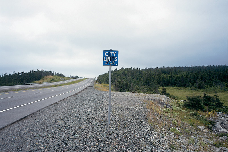
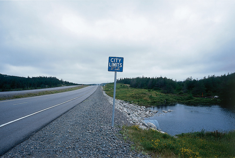
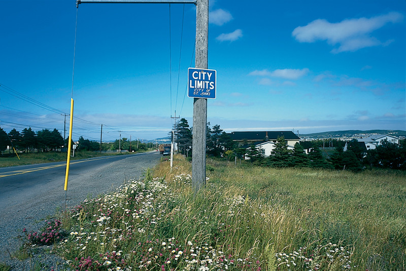
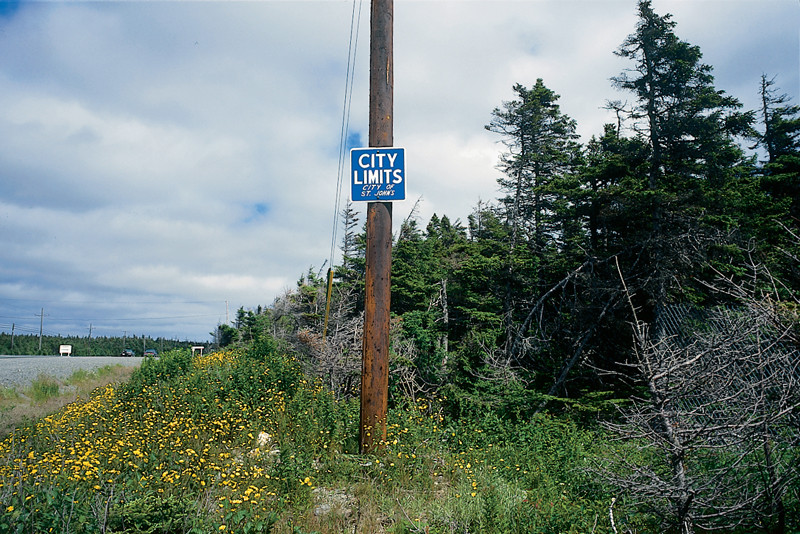
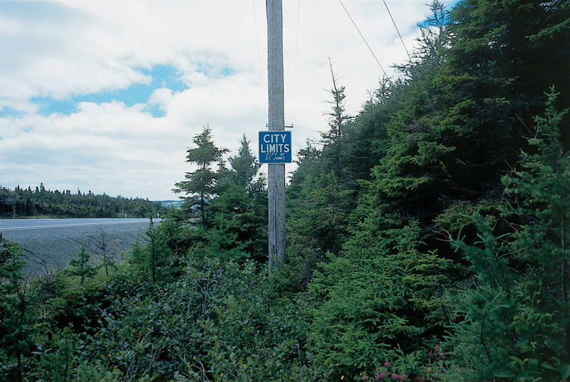
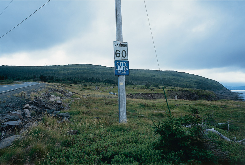
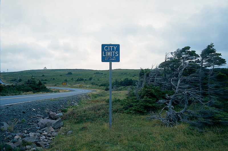
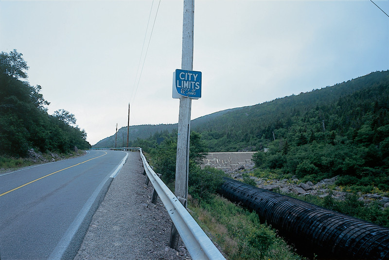
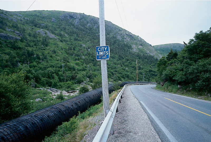
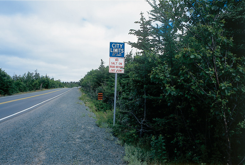
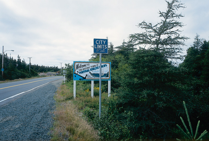
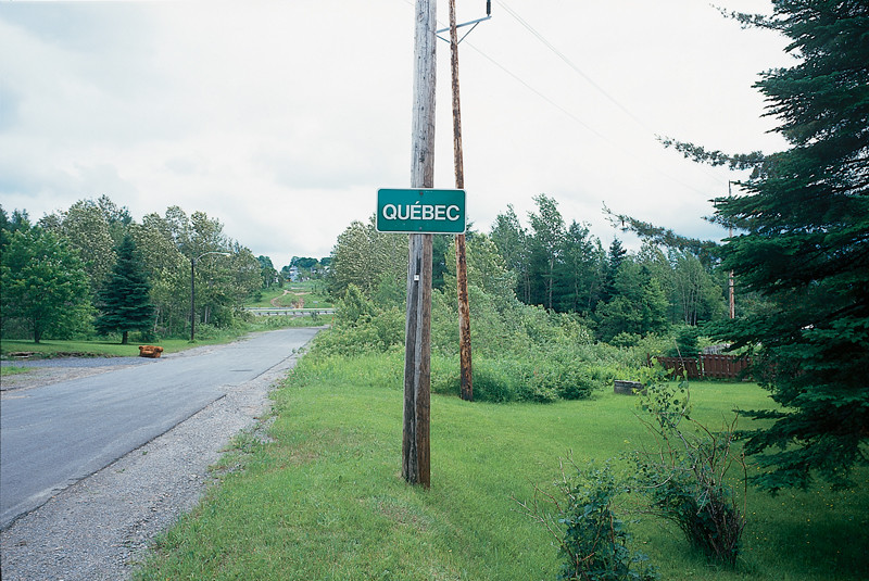
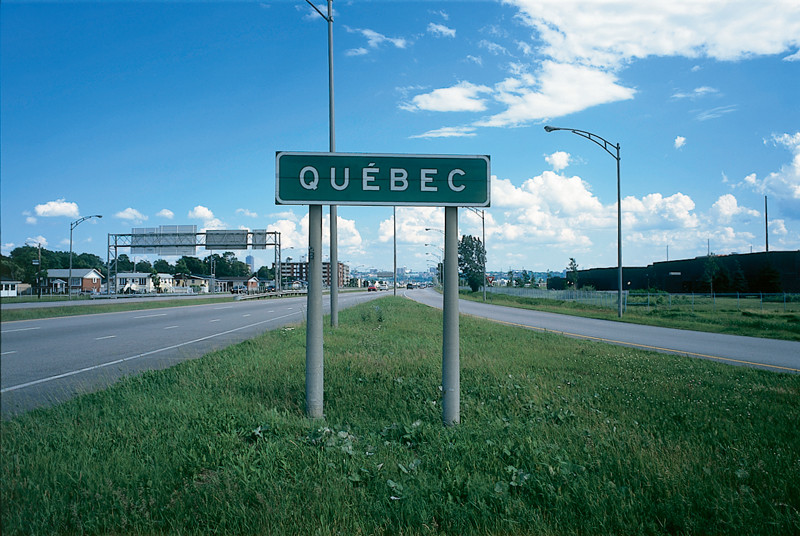
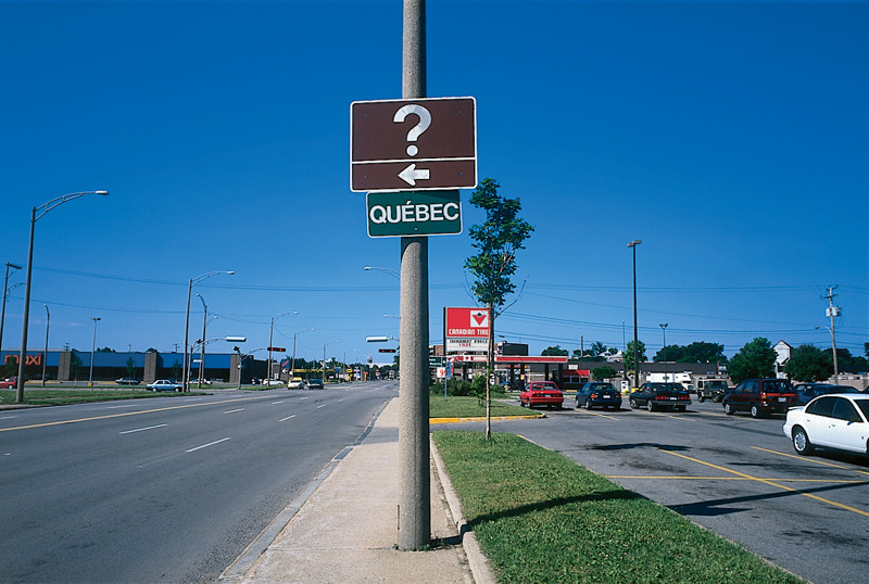
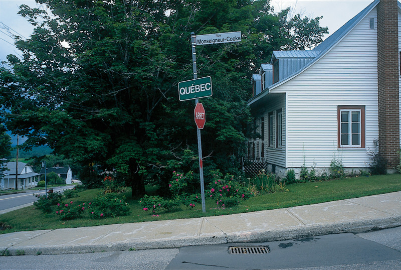
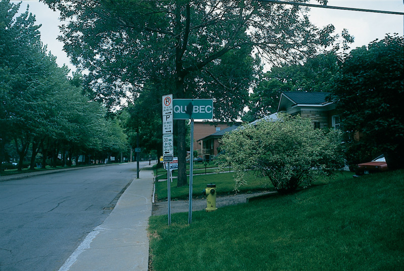
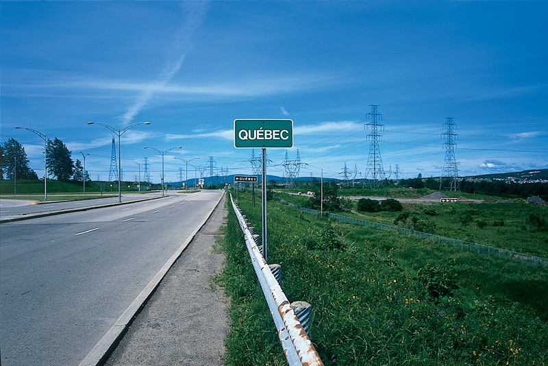
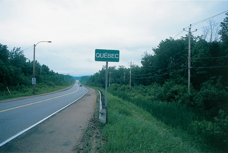
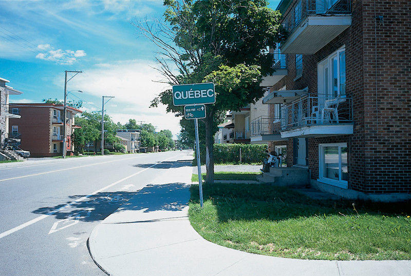
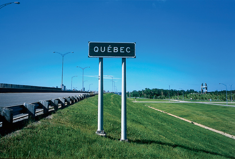
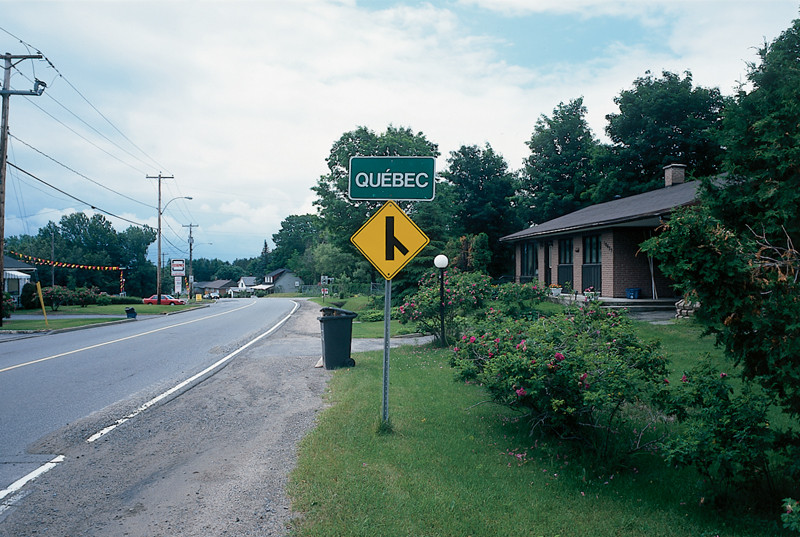
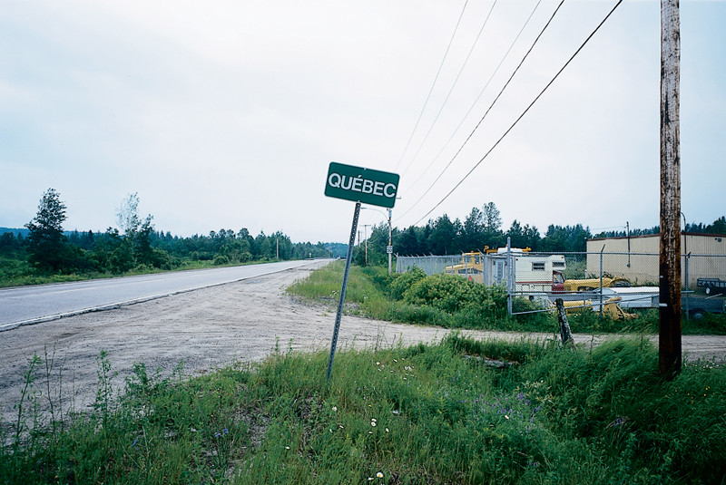
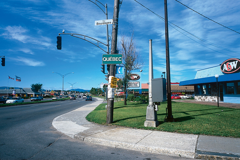
The work represented in these pages documents the signage used to identify the municipal boundaries of two cities: the respective capitals of the provinces of Newfoundland, where Creates lives, and Quebec, where this magazine is published. The artist has photographed any identifying signs posted where a road or highway crosses the city limits. Those visible in Entering and Leaving St. John’s, Newfoundland 1995 read “City Limits/City of St. John’s,” and appear on both sides of the road, visible to travellers in both directions. Those in Limites municipales, Québec 1997 simply say “Québec” and face in only one direction, toward people entering the city.
In a long history of work dealing with marked landscapes, Creates has moved from recording the artist’s mark on the land toward documenting the ways in which she finds landscapes already inscribed by social and political signifiers. In the late seventies and early eighties, Creates used colour Cibachrome prints to document her own landscape interventions. Her Paper, Stones and Water series featured marks that were, by their nature, ephemeral: an arrangement of stones at the water’s edge, a strip of paper laid upon the ground or floating on the surface of the water. The photograph is as much a record of the erosion of that intervention as it is a means of its preservation. Put another way, the essence of the intervention is in its deterioration: through its dynamic interaction with elemental forces, it fulfils its artistic purpose. Perhaps the most poetic work from this early period is Sleeping Places, Newfoundland 1982, for which the artist slept on the open ground in a sleeping bag and afterwards photographed (in black and white) the nestlike imprint of her body in grass or shrubs. The viewer knows that this impression is likely to have vanished with the next rainfall, as the plants sprang or grew back to fill the temporary space of human presence. The photographic impression the impact of photons upon the emulsion – leaves the only record that endures in social time.
These early interventions are marked by a delicacy of touch, a reluctance to impose her will too forcefully upon the material environment. The artist’s hand weighs lightly on the land: only the photograph remains as a residue of something we know is already absent.
Nevertheless, Creates’s early works are records of the artist’s own gesture, of the mark she herself has made. The balance began to shift in A Hand to Standing Stones, Scotland 1983, where Creates photographed her own hand pressed to the surface of megalithic monuments. This mark is the most minimal possible: the simple presence of the artist’s hand. The axis of tension in the photographs lies between the sign of the artist’s living flesh, in present time, and the sign of the stones themselves, marks made upon the land in prehistoric times for purposes that we cannot fully know. Creates began to focus on how other people, or a culture generally, name the landscape and represent it through verbal and visual mapping. Her works expanded into more complex assemblages involving portrait photographs of individuals, text and hand-drawn maps describing their memories of place, objects the artist collected from those places, and photographs documenting the places themselves. Within these works, the site photograph serves as a counterpoint to other means of representation. A series of works in the early nineties called Language and Land Use records the presence of public signs within landscapes, particularly landscapes understood to have a “natural” character in need of identification or protection, such as national parks and bird sanctuaries. Creates presents these black-and-white photographs as panoramas of three images each, the sign standing in the centre, flanked by its physical surroundings, and presented together with objects removed from the site, such as small stones or branches of vegetation. Implicit within these assemblages is a critical awareness of how the category of “nature” is socially constructed through language. The juxtaposition of sign and landscape is often paradoxical, even humorous, demonstrating the tensions that arise from the cultural effort to maintain and regulate the “natural.” These standing signs, and the ones that Creates documents in her present work, recall the standing stones she photographed in the early eighties. Both signs and stones are human interventions in the landscape, vertical markers that assert cultural meaning, that name the place in which they stand.
The standing stone in Neolithic cultures served as both a phallus and an omphalos the axis or navel around which the world turns. The ancient Greeks erected square stone pillars called herms as boundary markers. Bearing the face and the phallus of the god Hermes (patron of thieves, and crosser of the boundaries between worlds), they were numinous objects, small shrines at which offerings were made. Those offerings, according to some theories, were the origin of commerce: the place where objects of value were deposited and retrieved in a ritual exchange overseen by the stone gaze of the god.
The herm resembles the representation of another classical god, the Roman Janus, god of thresholds, usually represented by a two-faced pillar looking in opposing directions. Janus gives his name to the month of January, the boundary month between years. Both gods presided over liminal spaces boundaries and doorways where one thing comes into contact with, and becomes, another; the place where a line is drawn by law or culture.
The paired photographs in Entering and Leaving St. John’s, Newfoundland 1995 are Janus-like in showing the views in both directions from the same point along a highway. Those on the left show the view on entering the city, those on the right the view on leaving. We would be hard pressed to distinguish between the two views based on internal evidence: one hardly appears more urban or rural than the other. The city limit is arbitrary, a legal fiction that may not correspond to any recognizable change in the character or use of the land.
The pairing of this work with Limites municipales, Québec 1997 establishes an exchange of gazes between geopolitical subjects. Newfoundland and Quebec are the Canadian provinces most strongly inscribed with the signs of nationhood. One was once an independent state, the other harbours an aspiration to become one. Installed in the Quebec City gallery VU, Limites municipales allowed viewers physically situated in Quebec City to see the boundaries of their own city as observed by an artist residing in Newfoundland. The two series invite a comparison of views, an exchange of regards across boundaries.
An installation that Creates produced for Centre Est-Nord-Est in Saint-Jean-Port-Joli in the summer of 1997 anticipates this exchange. Sur la route menant le voyageur vers l’Atlantique records the responses of people in Saint-Jean-Port-Joli who had never visited Newfoundland to the question, “À quoi pensez-vous quand je dis Terre-Neuve ?” These responses appear on a sheet of plexiglass superimposed over a large colour Cibachrome print of the view across a patch of highway adjacent to the spot where the artist posed the question. The artist shows us her view of an ordinary scene in Quebec, while asking Quebecers to imagine a place they have not seen. Two imaginaries cross paths, facing in opposite directions.
Given the congruence between the name of the city and of the territory of which it is the capital, the signs in Limites municipales, Québec 1997 function as assertions of nationhood. They are declarations, naming the landscape as, indeed, Quebec. Nationalist resonances are particularly dense in the image where the sign appears against a backdrop of hydro towers. Since the nationalization of Hydro-Québec in the early sixties, such towers have been emblems of the national project. Perhaps they carry energy from Churchill Falls, purchased under the terms of a contract that, along with the very boundary of Labrador, constitutes a major point of tension between Quebec and Newfoundland. An additional sign bearing the name of Quebec is visible in the near background. With an arrow pointing left to a highway exit, it might suggest a political reading, and it interrupts an implicit narrative of linear progress. Barely has one entered Quebec City than one must exit to arrive there. The hydro towers, rather than facilitating the viewer’s imagined advance into the territory of Quebec, seem to block it, necessitating a detour to reach the destination so confidently named by the foremost sign. This contradiction brings to mind the collective trauma of last winter’s ice storm, which cast doubt on the utopian promise of state-managed technology.
The sign is a point of social control, and thus a point of conflict. By a visual comparison of how two cities inscribe their jurisdiction within the landscape, Creates continues a subtle and coherent investigation into the relations between the sign and the landscape that it marks.
We thank the artist’s generous contribution, without which publication of this portfolio in colour would not have been made possible.
Robin Metcalfe is an independent critic and curator living in Halifax, where he chairs the board of the Khyber, an artist-run centre. He recently curated the nationally touring photography exhibition Carl Zimmerman: Lost Hamilton Landmarks for the Saint Mary’s University Art Gallery. His writing has appeared in Canadian Art and MIX and he is the Halifax editor for C Magazine.

